12 December 2011

Puno, Peru: Floating Islands, Lake Titicaca, and Ruins

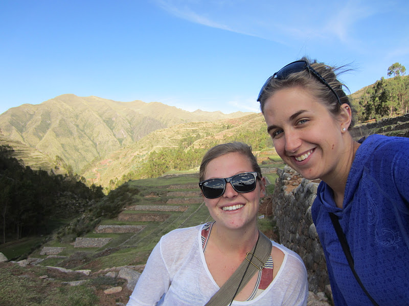
This weekend, some friends from school and I took the seven-hour bus ride to Puno, which is in the south of Peru, about two hours by land from the Bolivian border.  The non-land border, which is much closer, runs right through Lake Titcaca, which is the main attraction of this area.  Since Americans have to pay a $140 entrance fee for Bolivia, I didn't go, but there was plenty to see and do around Puno.  When we got there on Friday, we explored the city a bit, but it was rainy and we had been on a bus all day, so we basically ate and went to sleep.  Saturday morning, we got up bright and early to tour some of the islands in Lake Titicaca.  This is Joao (Brazil), Bastien (Switzerland), and I on the boat on the way to our first island.

Here is a shot of our first island!  This island, Amanecer (which means 'sunrise' in Spanish), is one of a group of about 56 floating islands in Lake Titicaca called Uros.  Yes, you heard me right: floating.  These islands, each of which houses two to eleven families depending on size, are built on big blocks of earth and reeds, layered and layered, and are then anchored to each other or to one of the stone islands in the lakes.  Whenever people want to move their house, they literally just pick up anchor and float around.  It was incredible to be standing on this thing and know that it was movable!

Also cool were the 'taxis' that are used to transport people from one island to the other.  Made of reeds and wood, they really are works of art.

After Amanecer, we visited one more island where it was possible to buy souvenirs (I was more interested in the great shot of a whole group of Uros islands, as you can see above), and then we were off on a two-hour boat ride to our next island.  The boat ride itself was also cool, especially if you think about that it was on the highest lake in the world (3850m, or roughly 12,000ft), and the biggest lake in South America (for all you Michiganders out there, no, it's not bigger than Lake Michigan).

Here are the three of us on the 5 km by 2 km island of Taquille.  This island, which is solid stone, houses about 900 inhabitants, most of whom are either farmers or artisans.  The 2.5-km walk to the town center was steep, but the views of Lake Titicaca on the walk made it well-worth it.  In the picture above, the left half of the lake belongs to Peru, and the right half belongs to Bolivia.  Nifty!

We had lunch on this island, and then walked down to the southern port, where Joao and I and two Venezuelan fellows went swimming in Lake Titicaca!  It was really cold (think Lake Michigan in early June), but really clean; unfortunately, I don't have pictures, as they are on Joao's camera, but I thought it was still worth mentioning :-)  We then took the two-hour boat ride back to Puno, where it was time for dinner and some great views of the city by night from our hotel.

Sunday was day of ruins, with the first stop being Chucuito, a city about twenty minutes from Puno whose main attraction is a pre-Incan fertility temple.  Apparently, in the ancient world, 'fertility temple' meant 'let's carve a bunch of penises', but it any case, it was interesting to see.  Also interesting was the fact that our guide was a girl who couldn't have been more than eight years old...but she sure knew what she was talking about!

The next stop on the Sunday of ruins was Sillustani, an Incan cemetery on the shores of Lake Titicaca about 40 km north of Puno.  Unfortunately, just as we got there, it started thundering and lightning and hailing, which made the walk up to the ruins a bit chilly, but it was still worth it!  The Incans buried their dead in giant towers here, and, as is standard for Incan ruins, the stonework was absolutely amazing (and even though it was stormy, the lake was still pretty).  After this, we headed back to the hotel to wait for our 9:30pm overnight bus back to Cusco.  Puno and Lake Titicaca were both very interesting, and the floating islands were incredible...what a great way to spend my last weekend abroad!

08 December 2011

Cusco, Peru: Jumping from the Highest Point in the Americas

Today, my friends and I went bungee jumping from the highest point in the Americas (the second-highest jump is in Canada, and is 118m).  At 122m (400ft), the initial jump is a free-fall of approximately 100m (328ft).  Here is a shot of the four of us before jumping--needless to say, we were a bit nervous.

Here I am in the cage on the way up...

...and then I jumped!

The initial free-fall was by far the coolest part, but the recoils and hanging in mid-air hundreds of feet above the ground definitely didn't suck either.

The four of us after our jumps, with our we-did-it t-shirts!  I would highly recommend bungee jumping to anyone looking for an an adrenaline rush...I've never experienced anything like it!

06 December 2011

Cusco, Peru: A Cultural Evening

Yesterday evening, I went the Cusco Center of Native Art to see some traditional dances, listen to some traditional music, and complete my tourist ticket.  This was the opening dance, which originates in Cusco.

This dance, from a different region in the Cusco province, showed off the incredible skill of both the dancers and the musicians.

This dance was dedicated to the rain, and was accompanied by some nice special effects on the part of the theater.

One of the last dances, originating in Incan times, was a dance for the time of sowing the fields.  These costumes were my favorite (though all of them were great) because they were accompanied by real old-school hoes.  It was a lovely evening, and I'm glad I got to experience a bit more of the Peruvian culture before I leave.

05 December 2011

Cusco, Peru: Tipon and Pikallacta and Saylla

Yesterday, Christine and I set out to make a gastronomic and historical exploration of the area east of Cusco. Our first stop was Tipon, which is famous for both cuy and ruins. For those of you who don't know, cuy is guinea pig, which is a delicacy in Peru. Christine and I split one, and while it wasn't bad (it kind of tasted like baked chicken), I'm not sure the dish is going to catch on in the US anytime soon.

After our lunch of guinea pig, we walked up to the ruins of Tipon—actually, we walked about halfway, then a lovely Cusquenian couple stopped and offered us a ride, so we rode the last 2 km. Tipon is the Incan site that is famous for its irrigation; unlike many other places, here, the irrigation channels were dug partially above ground, so they make a beautiful cascade down the terraces. And, as you can see in the photo above, they still work!

The view of the Sacred Valley was also pretty spectacular from here. We were lucky to get such a good day during rainy season!

After Tipon, we caught a bus and a taxi further east to the ruins at Pikallacta, which is actually a pre-Incan site. These ruins were built by a people called the Wadi, and as you can see from the picture, have a different, more primitive stonemason style than the Incans.

This place was also interesting because it really felt like the remains of a city. The red walls and dirt were laid out in rows, which appeared to be the remnants of ancient streets. I really want to do some research to find out what went on here—it intrigues me.

Our final stop of the day was Saylla, which is a small town on the way back to Cusco that is famous for chicharron—deep-fried pork skin. Much to our delight, they don't only fry the skin of the pork, but also the meat, so we split a delicious (and giant!) meal of pork skin, pork, potatoes, corn, and popcorn. It was a definite high note for both of us during our Sacred Valley exploration. Yum!


04 December 2011

Cusco, Peru: The Ruins at Chinchero

Yesterday, Christine and I took the bus to Chinchero, another set of ruins about an hour from Cusco.  Chinchero is supposedly the birthplace of the rainbow, though we have yet to find anyone who can tell us why.  Still, the day was beautiful, and the ruins are delightfully low in the hills, right on the edge of town.

Chinchero, because of its low altitude, was a farming center, which is why you can see the remnants of many terraces behind us.

We also found a rock with what we assumed to be a throne carved into it.  We took turns pretending to be the queen, and a stray dog who accompanied us for our entire trip through the ruins posed beautifully for the pictures!

The last place we visited before heading back to Cusco was a church that the Spanish conquistadors built right on top of the Incan ruins.  Unfortunately, we couldn't take pictures on the inside (the picture above is on the outside), but imagine the whole church—including the wooden ceiling—beautifully painted with images of saints and flowers and angels.  It was amazing, and unlike any church I have ever seen.  All in all, Chinchero was a great trip!

Cusco, Peru: The Ruins at Pisac

On Friday, Sharon, Joanne, and I took the bus to Pisac, some ruins about an hour from Cusco.  Pisac, like most of the Incan ruins I have seen, features a city perched on the top of a hill, with agricultural terraces ringing the mountain below the city, as well as the surrounding hills.  We got there at about 2pm, had some lunch, then began the 5km (600m of elevation gain) hike to the top.  Here I am near the bottom...

...and here are the three of us about halfway up, where we started to see temples and houses that were once part of the city.

After a continued steep climb, we were able to see the Incas' famed trapezoidal doors, which have withstood the tests of time and thousands of earthquakes.

We also examined the aqueduct system of the city, which is still in existence and functioning today.

Finally, from the very top, we were able to look down on the biggest part of the city that is still standing from above.  The views of the surrounding area were also breathtaking, and well-worth the steep climb.  After we spent a bit of time exploring the city, it was time for the walk back, then the bus ride back to Cusco for a night on the town with all the students from my school.  Fun times!

01 December 2011

Cusco, Peru: A Bit More Culture

Today, some friends and I set out to explore some of the other sites on our tourist tickets.  Our first stop was the Monumento Pachacuteq, which you can see behind me.  Pachacuteq was one of the last and greatest Incan kings, and was the impetus behind many of the Incans' incredible architectural and agricultural advances, as well as some of their amazing city planning and constructions (including Machu Picchu).

Each floor of this tower was dedicated to explaining an aspect of Pachacuteq's life, and it was, in general, very well done.  Plus, the view of Cusco from the top was amazing!

After the monument, Sharon and I caught a taxi up to Saqsayhuaman, an archaeological site near Cusco.  Though much of the city is gone, the crazy walls with their incredible stonework were still visible, so we spent some time wandering about and admiring the craftsmanship in the ruins.

Check out how huge the stones that comprise the wall behind me are!  I am always amazed that the Incans managed to move these stones from so far away.

After Saqsayhuaman, Sharon and I walked up a nearby hill to see the statue of Christ that overlooks the city (and is incredibly well-lit at night).  Though its official name is Christo Blanco (white Christ), I have affectionately dubbed it Giant Jesus.

The view from Giant Jesus--all of Cusco laid out in the valley below us--was pretty spectacular, though this picture certainly does not do it justice.  All in all, Sharon and I had a great day exploring more of Cusco's culture!